Railway bridge construction over Dupont St.
Tue, 2011-01-04 17:03 — vic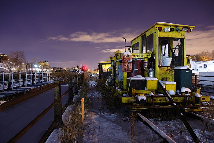
December 14, 2010. An alternate view of the photo I posted a couple of days ago. This ramshackle-looking CN railway vehicle was parked on the bridge over Dupont St. at Dundas West for the construction of another railway bridge span. To me, this vehicle almost looks abandoned, though I've seen it in use at various places along the Georgetown tracks during recent construction. The somewhat desolate view north from here towards the West Toronto Diamond (aka The Junction) also makes me think of a more rundown rural or small-town setting. In the distance, you can still see the one remaining St. Mary's Cement silo on Junction Road. It's sister silo was demolished this past autumn.
Dupont St. bridge construction + Planet Storage
Mon, 2011-01-03 10:30 — vic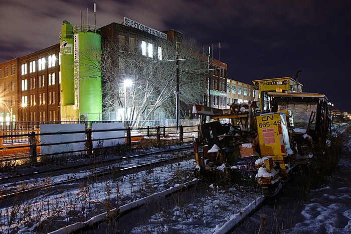
December 14, 2010, on the railway bridge above Dupont St. at Dundas St. West. During the next few days after this photo was taken, a new bridge was constructed between the bridge I'm standing on and the West Toronto Railpath (the orange bridge on the left). This is all part of the railway expansion project for GO Transit's Georgetown line and the Airport Rail Link. In the background is the Planet Storage building, formerly Viceroy Rubber.
Happy New Year!
Sat, 2011-01-01 22:24 — vic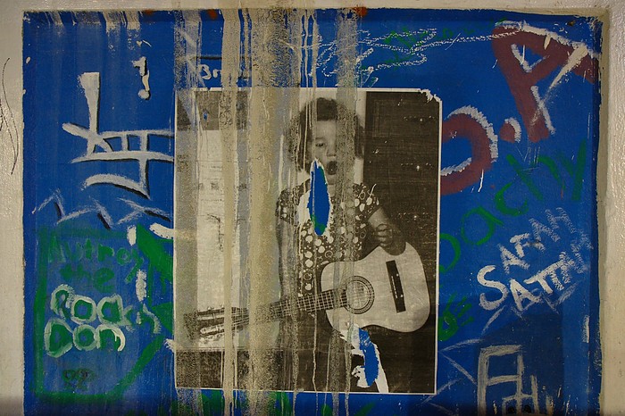
Hope you have a rockin' 2011. I have definitely signed myself up for some fun, excitement, and many challenges this year. :)
Photo taken on December 14, 2010, under the railway underpass on Dupont St. at Dundas St. West, while I was out taking some photos of the bridge construction. Will post more of those soon.
Sweat CANCELLED due to weather
Wed, 2010-12-15 06:00 — vic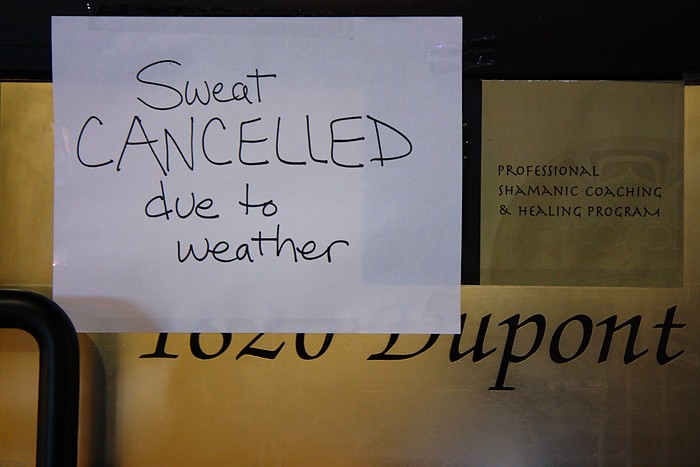
December 14, 2010. It was a cold evening, about -10C, but still a nice night for a walk around the neighbourhood. This sign on Dupont St., near Edwin Ave. caught my eye. "Sweat cancelled due to weather". Yeah, I wasn't sweating much at all, that's for sure.
San Francisco: XX Take Rope XX
Tue, 2010-12-14 17:42 — vic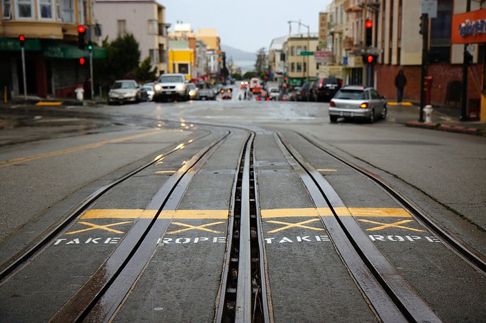
October 17, 2010. Cable car tracks on Powell St., looking north to Jackson St., San Francisco. The sign instructs the cable car operators to pick up the cable again after rolling down a hill.
If I were to take this photo again, I would try to jump out into the street right after a cable car went by, so that I could capture it rounding the corner. But that could have taken some time, as dodging other cars is pretty important too when taking (literal) street photos. I was in a rush to walk around and see as much of the city as possible during my short two-day visit.
San Francisco: Willie "Woo Woo" Wong Playground
Sun, 2010-12-12 22:03 — vic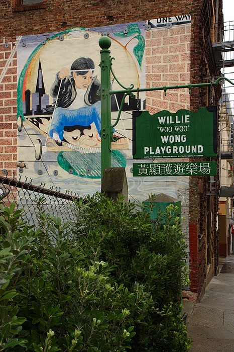
October 17, 2010. Willy "Woo Woo" Wong Playground, in Chinatown, San Francisco.
From Wikipedia:
Willie "Woo Woo" Wong was a Chinese-American basketball player who was born and raised in San Francisco's Chinatown. Wong, who only stood 5'5" tall, starred at Poly and Lowell High School's in San Francisco before being recruited to the University of San Francisco (USF) by legendary coach Pete Newell. Wong was known as one of the finest Chinese-American basketball players in his time. After his time at USF, Wong continued to compete at various local and national tournaments as part of the San Francisco Saints team. Wong died at the age of 79. After Wong died, local residents successfully petitioned the City and County of San Francisco to rename "Chinese Playground" to "Willie "Woo Woo" Wong Playground".
San Francisco: Tunnel Top
Fri, 2010-12-10 13:51 — vic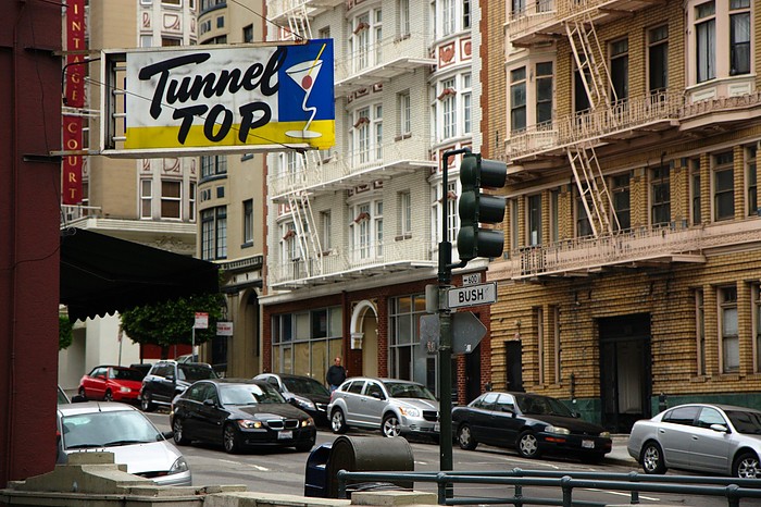
October 17, 2010. The Tunnel Top bar on Bush St., above the entrance to the Stockton St. Tunnel, San Francisco.
San Francisco: ԀƎƎʞ OUT
Thu, 2010-12-09 06:00 — vic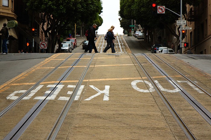
October 17, 2010. Cable car tracks on Powell St. at Bush St., San Francisco. It's a steep hill, so I guess that's why they want everyone else to "keep out" of the way of the cable cars.
San Francisco: Nuns, liquor, and adult cinema
Wed, 2010-12-08 13:17 — vic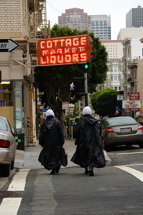
October 17, 2010. At the corner of Bush and Mason, Nob Hill, San Francisco. Nuns in raincoats walking past the liquor store towards the adult theatre.
San Francisco: Nitecap
Sat, 2010-12-04 09:35 — vic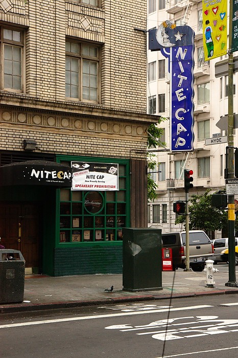
October 17, 2010. The Nitecap bar, at the corner of O'Farrell and Hyde in The Tenderloin, San Francisco. This was another one of my favourite signs, though I didn't manage to get a photo that I really liked.
Still, I think my all-time favourite bar sign is from right near my own neighbourhood in Toronto. Check out this 1960's photo from the City of Toronto Archives, where you can clearly see the old sign at Duffy's Tavern, at the corner of Bloor and Margueretta. I wish that sign was still there.
